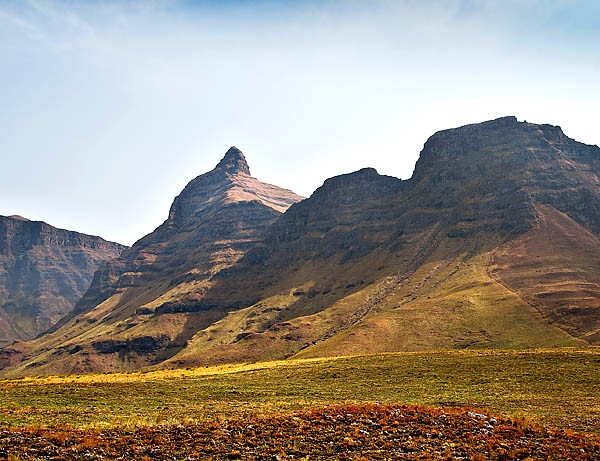
A peak in the Drakensberg has been named Rhino, after the much-poached and endangered animal. Rhino Peak tops out at 3,051-metres. A route has been devised, which runners and hikers can do – for fun or as an attempt to set a Fastest Known Time (FKT) on the route. The first ‘running’ is an invite-only organised activity on 22 September 2015, where a benchmark FKT will be set.

Thereafter, from 23 September 2015, any runner can register their Rhino Peak FKT attempt on the rhinothepeak.co.za website for a fee of R450. While this excludes the daily Ezemvelo Garden Castle permit fee and guide fees, you do get a certificate, one of Tod Collins’ collector map prints of the mountain and the Rhino Peak people will post your photos and story of your attempt on their website. The money left over after this goes to the maintenance and upgrading of the RHINO, The Peak trail and rhino conservation.
Rhino, The Peak, is situated in the Underberg region of the southern Drakensberg. The out-and-back route totals 20 kilometres with 1,211 metres of climb. Accomplished trail runners should take around three hours; casual hikers may take a few days.
The trail starts at the Ezemvelo Garden Castle office, elevation 1,840 metres, and follows a well defined trail along the Mlambonja river to Pillar Cave. If you plan to complete your Challenge over more than one day, Pillar cave and its annex is the ideal overnight spot. From the cave the trail follows the Mlambonja river and skirts up the side of Mashai pass to the rim of the Maloti-Drakensberg escarpment. From there the route traverses a two-kilometre stretch of level escarpment and the summit of RHINO, The Peak is reached via a short, bouldery scramble. The altitude here is 3,051 metres.
The website for this is www.rhinothepeak.co.za and they also have a Facebook page at Rhino. The Peak.
If you’re looking for other FKT routes to attempt, Ryan Sandes has a FKT route on Table Mountain. Initiated in March 2015, it is a 15.1km route with 1,070m ascent and 949m descent. The route starts from the Suikerbossie Restaurant, passes through three designated points and finishes at the SANParks Information Centre on Lower Taferberg Road. The route includes the Llandudno Ravine and the Kasteelpoort beacon, from where it routes through the Valley of the Red Gods and toward Platteklip Gorge. Then via the Upper Table Mountain Contour path it winds to the Kloof Nek corner beacon and on to the finish.
Although the competition on the Red Bull website for this FKT is closed, you can give it a go anytime and see how you stack up. FKT leader is Martin Kleynhans with 2:00:01. Landie Greyling tops the women’s ranking with her 2:20:48.
As Red Bull has removed the route description from their website, I found a copy on Ian Corless’ site.
Detailed Route Description (step-by-step)
Start at the main entrance gate to Suikerbossie Restaurant and run towards Llandudno Ravine (Hout Bay Trail Challenge leg 2 route).
Head up Llandudno Ravine where the first Check Point will be a quarter of the way up the climb.
Once on top of the mountain, follow the trail towards Kasteelpoort and do not take any of the turn offs, including the turn off to the WoodHead Reservoir.
Once you reach the beacon at the top of Kasteelpoort, continue straight through the Valley of the Red Gods and towards Platteklip Gorge.
Do not take the turn down to Kasteelpoort.
You will pop out at the top of Platteklip Gorge where Check Point two is. Head down Platteklip Gorge but DO NOT run all the way down to Tafelberg Road.
You must take the Upper Table Mountain Contour path towards Kloof Nek corner (you will run under the Cable Car) and turn down right on the trail once you get to the Kloof Nek corner beacon.
The third and final Check Point is on the Kloof Nek corner trail heading down towards Tafelberg Road.
Follow this trail down to Tafelberg Road. Once you hit the road, turn left follow the road down to the SANParks information centre in the parking-lot where the Table Mountain Trail Challenge starts.
Touch the far left-hand side (if you are facing towards the city centre) of the information hut and you have finished.